farm surveying and planning, Farm planning can also be defined as the process by which measuring of land is made on the farm.
Such measurements by tables, plans or layouts are done for specific purposes.
farm surveying
MEANING OF FARM SURVEYING
Farm surveying is defined as the process of measuring and mapping out the position, soil topography, size and boundary of an area of farmland.
It can also be defined as the process by which measuring of land is made on the farm. Such measurements by tables, plans or layouts are done for specific purposes.
IMPORTANCE OF FARM SURVEYING AND PLANNING IN AGRICULTURE
Reasons, why farm surveying is important, include the following:
(1) Determination of the size of farmland: A farm survey helps to determine the size or hectares of farmland.
(2) For feasibility studies: A farm survey is also important or useful for the preparation of feasibility studies.
(3) Proper use of farmland: Farm survey enables farmers to make proper use of the land.
(4) Location of farm buildings: Farmers can determine where to site and locate certain buildings or structures in the farm.
(5) Planning of farmstead: Farm maps or soil maps are useful in planning the farmstead.
(6) For soil classification: Characteristics and features of the various soil units are used for soil classification.
(7) Projection of yield: The yield or productivity of farmland can be projected.
(8) For collateral security: Results of the farm survey can be used as collateral for securing loan from financial institutions.
(9) Acquisition of certificate of occupancy (C of O): Farm survey facilities acquisition of certificate of occupancy (C of O).
(10) Determination of the gradient of farmland: A farm survey also helps to determine the gradients of the farmland.
(11) Construction of roads: Road and other access ways can be constructed with the knowledge derived from surveying.
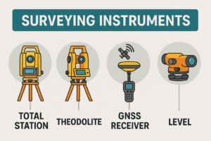
SOME COMMON FARM SURVEYING EQUIPMENT/INSTRUMENTS AND USES
Some common surveying equipment or instruments.
(1) Ranging pole
(2) Gunter’s chain
(3) Measuring tape
(4) Prismatic compass
(5) Theodolite
(6) Arrows or pin
(7) Offset staff
(8) Beacons or pillars.
more about farm implement here
Ranging pole farm surveying and planning
Description
(i) Ranging pole is made of wood or metal
(ii) It is of varying lengths e.g 18m, 2.4m, or 3.0m
(iii) It is generally circular in section, though some octagonal types are obtainable.
(iv) It is usually painted black, bright, red and white to enable it to be seen from a distance.
(v) It has a pointed end.
Function/uses:
(i) It is used for making stations
(ii) It is also used for making straight lines

Gunter’s chain
Description
(i) It consists of a series of dumbbell-shaped links of steel wires joined together by three small rings
(ii) One gunter’s chain is normally 20.13m (66ft) in length.
(iii) It has brass handles on either side.
(iv) It is divided into 100 links so that each link is 19.8cm or 7.92 ins.
(v) A link is the distance from the middle of the central ring to the middle of the next central ring.
(vi) The chain is entirely metallic. for farm surveying
Precautions to be taken when chaining farmland during farm surveying
.
(i) Pull taut chains, tapes or ropes
(ii) Avoid errors in transporting figures on papers
(iii) Equipment such as theodolite should be placed on a perfect horizontal plane.
(iv) All chains, tapes, ropes, etc must be properly aligned before taking measurements.
(v) Avoid the error of parallax when reading measurements.
(vi) Make sure the chain is not faulty before use.
Function/use
It is used in taking short or detailed measurements of length and breadth
Measuring tape for farm surveying
Description
(i) It is usually made of linen of fine steel sheet.
(ii) It is usually marked on one side with metric units and the other side with the imperial unit.
(iii) The tape is of various types and lengths used basically for measuring the length and breadth of a farm mapped out for survey
(iv) The tape is normally wound in a small case from where it is unwound for use.
Function/use
It is used for taking measurements of length, breadth and height.
Prismatic compass
Description
(i) It is normally placed on a stand
(ii) It has a prism
(iii) It has a compass card marked in degrees, half degrees, minutes and seconds in a clockwise direction.
(iv) It has a straight slot. 
Functions/uses
It is used in taking bearings; it is also used in measuring angular distance.
Theodolite
Description
(i) It consists of a tripod stand made of wood of lightweight metal solid or telescopic legs.
(ii) The tripod stand forms the base of the instrument
(iii) It has a lower plate which contains the graduated horizontal circle made of glass or brass
(iv) It has a spirit level which is used to define horizontal plain against which angles of the elevation or depression are measured
Function/use: It is used to measure horizontal or vertical angles or planes.
Arrow or pin
Description
(i) This is a thin pointed steel wire of about 3cm long with one end curved into a ring
(ii) A red cloth is normally attached to the ring so that it can be seen from afar.
Functions/uses
(i) It is used during chaining for marking off-chain lengths as measured
(ii) It can also be used for marking stations
Offset Staff
Description
(i) This is a graduated rod-3m long
(ii) A hook may be fitted at the top for the purpose of pulling a chain through a hedge
(iii) Each telescope link is 0.3m (30cm) in length
Function/Use
(i) It is used for taking short offset measurements
Beacon or Pillar used for farm surveying
Description
(i) It is made of rectangular blocks usually in concrete form
(ii) Marks are usually inscribed on top of the block
(iii) The beacons are always buried in the ground with marked heads raised a little above the ground
Function/Uses
(i) It is used for making off-points measured
(ii) It is also used for the recognition of the measured
read about simple farm tools here
General Maintenance of Surveying Instruments
(i) All instruments must be clean after use.
(ii) Keep instruments in dry and cool places
(iii) Those with metals parts should be oiled or greased or painted before they are put away for a long time
(iv) Keep instruments like farm tools away from heat and rain(water cycle) to prevent damage and rusting respectively.
(v) Replace worn-out parts
(vi) Use instruments only for the intended functions
(vii) Let the competent surveyor hand and use the instruments only or as he may direct.
you can read about maintenance of farm implements here
IMPORTANCE OF FARM PLANNING
(i) Farm surveying enables the farmer to make proper use of the land
(ii) It also ensures the proper sitting of certain buildings or structures in certain locations within the farmstead
(iii) farm surveying ensures the location of livestock buildings in relation to other farm buildings
(iv) farm surveying promotes neatness and prevents pollution within the farmstead
farm surveying and planning can also be defined as the process by which measuring of land is made on the farm. Such measurements by tables, plans or layouts are done for specific purposes.
159. TAPE WORM
160. ROUND WORM OF PIGS
161. LIVER FLUKE
162. ECTO PARASITES
163. TICK
public enterprises
limited liability companies
how businesses raises funds for expansion
Originally posted 2025-07-27 01:34:46.